Thank you for requesting more information about the Ohio to Erie Trail by signing up for our newsletter. Our official newsletter goes out 2 times per year and will be sent as an electronic newsletter to your email address. Our most recent newsletter is our Spring/Summer 2022 version and it can be viewed online on our website along with 19 past newsletters.
This riding season there are several short and long term trail construction projects and our ALERTS page is the best resource to make your travel adjustments.
We are a non-profit organization and donations make it possible for progress on the trail to continue. We saw a record number of trail visitors last year and expect another record-breaking year in 2022. We’ve recently scheduled a series of webinars for visitors to learn about the trail and make plans for multi-day trips along it, sight-seeing and enjoying the amenities that our trail partners have created and maintain along the way. The webinars are posted to our YouTube channel for further sharing.
It is through the generosity of our donors that we have been able to support our trail partners and work to close the remaining gaps of 44 miles of the 326-mile route. Thank you for your interest in the Ohio to Erie Trail and we hope you will make a donation to help us in transforming the Ohio to Erie Trail for everyone’s enjoyment!
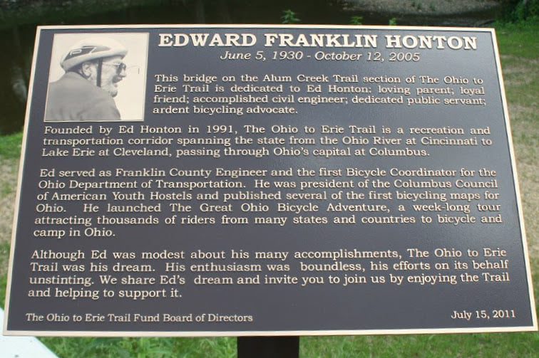
Ohio to Erie Trail Song by Eric Nassau and friends, 2005 Dedicated to Ed Honton
Founder of the Ohio to Erie Trail, Edward Franklin Honton, June 5, 1930 – October 12, 2005Eric Nassau, Alum Creek State Park Event, June 10, 2022 Photo Credit: Lisa Daris
Ohio to Erie Trail Song by Eric Nassau and friends, 2005 Lyrics
There’s a trail that I know Weaving its way across this great state, Ohio Hearty and Hale
In my mind, I can see The way our forefathers imagined this country to be As they dug canals and laid down the rails
Welcome aboard the Ohio to Erie Trail
Take the ride of your life Bring the whole family along for a leisurely hike Go as slow as a snail
Take your time, look around Hear the sweet sound of birds in the air And the buzz on the ground in the wildflower veil
Find it all down at the Ohio to Erie Trail
So pump up your tires Lace up your shoes Strap on your skis and Discover your muse Our children will grow up And always have known, You can cross this whole state and hardly touch a main road
We’ll write a new story We’ll tell a new tale We’re bound for glory The Ohio to Erie Trail
Prairie path lined with trees Watching the corn and the soybeans sway in the breeze Family Farms, Golden Hay Bales Pass through towns you never knew Skyscrapers rising surprise you from out of the blue Where we will regale the joy in the journey The Ohio to Erie Trail
So pump up your tires Lace up your shoes Strap on your skis and Discover your muse Our children will grow up And always have known, You can cross this whole state, hardly touch a main road
We’ll write a new story We’ll tell a new tale… Ed Honton’s vision it will prevail Welcome aboard the Ohio to Erie Trail
The newest segment linking Delaware, Licking and Knox Counties is NOW open! New Trail Guides will be printed this Fall and until then, an updated NC4 map panel is now available for download here.
Starting Monday May 9, 2022, and lasting approximately 8 months, the Little Miami Scenic Trail will be closed at Grandin Road for a project to replace the King Avenue bridge, add a roundabout, and realign the Trail itself. The Warren County Engineer’s office announced the specific date for this closure on April 28, 2022. There will be no detour for this closure. Visit MiamiValleyTrails.org for details. https://www.miamivalleytrails.org/little-miami-scenic-trail-closed-grandin-road If you want to talk with someone who has been through there recently, join the Facebook Enthusiast Group and post your question. There are over 10,000 members already, so you may get lots of advice!
5/16/22 – The Ohio to Erie Trail Interactive Map provides an option for going around the Little Miami Scenic Trail closure in Warren County.
For the Ride with GPS instructions for the Grandin Road Construction Optional Street Route: https://ridewithgps.com/routes/39462376 Road route from Foster’s Park Trailhead to South Lebanon Trailhead
The closed portion of the Towpath just south of Ernie’s Bike Shop in Massillon has been extended. The trail is now closed from Lake Avenue to the Tremont bridge. Ernie’s Bike Shop has provided a bypass route suggestion. Go to: https://www.erniesbikeshop.com/towpath for route and map.
If you have questions about navigating this part of the trail, stop by the bike shop at 135 Lake Ave NW, Massillon, OH 44647 or call 330-832-5111. Read more at https://www.erniesbikeshop.com/towpath where you can Download Printable Directions.
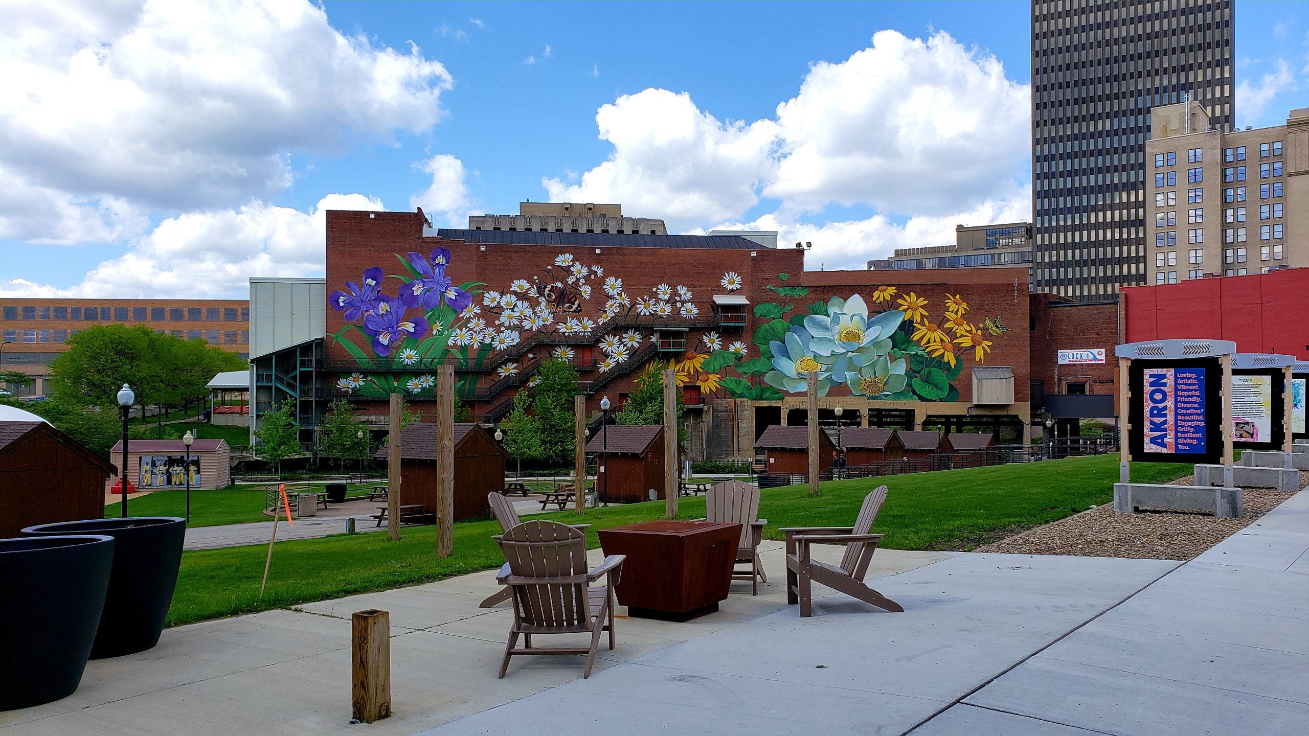
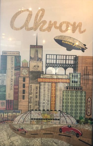
Tires rolled out of Akron during the past century giving the city the nickname as the Rubber City. Akron’s legacy as a center of industry and commerce preceded the days of rubber with the Ohio and Erie Canal. Cyclists on the Ohio to Erie Trail pedal through the artifacts of canal days and the rubber industry.
The Ohio to Erie Trail follows the path of the Ohio and Erie Canal Towpath Trail (Towpath Trail) through Akron. Akron Civic commons brought together several civic institutions in recent years to reimagine the city’s industrial and commercial past as public spaces where people gather, play, and build community.
The reimagination of the Towpath Trail gives Ohio to Erie Trail visitors a gateway through the heart of these vibrant public spaces.
Summit Lake
The Towpath Trail’s floating towpath floats along the eastern shore of Summit Lake. Summit Metro Parks opened the Summit Lake Nature Center earlier this year reimagining an early 1900’s amusement park building into a modern interpretive center focusing on wildlife education, urban gardening, and water-based recreation.
A view of Summit Lake from the Nature Center
Ohio and Erie Canal Park
Ohio and Erie Canal Park is a short distance north of the I-76/I-77 underpass on the Towpath Trail. The neighborhood has been reimagined with murals, public art, and places to gather, reflect and relax. Ohio to Erie Trail visitors meander through an urban oasis of a gently rolling trail along the Ohio to Erie Canal.
Akron’s Civic Gateway
Akron’s Civic Gateway reimagined Downtown Akron as a welcoming space for the community and visitors. Main Street saw the addition of a protected bike line, streetscaping, and numerous art installations. Murals on the northern and southern walls of the Akron Civic Theater serve as dramatic backdrops for Lock 3 and Lock 4 Park, gathering spaces for entertainment and community events.
Northside District
Vibrant murals and public art are plentiful in Akron’s Northside District. This is the city’s art district with many galleries, entertainment and dining venues. Northside Marketplace is home to a diverse collection of unique shops and dining. The Cuyahoga Valley Scenic Railroad Northside Station sits on the northern end of the district.
Many of us accomplish 100K or even 100 miles of cycling on the trail, but how many of us accomplish this before we turn 10 years old? Get ready to be inspired!
The first time Arbor Lang rode a section of the Ohio to Erie Trail, ice cream played a big part in her vow to return for a longer bike ride. The same could probably be said for many of us.
That next June of 2019, Arbor returned and rode 100k on the trail!
Another year, another goal, and that year, Arbor set her sights on a century ride – 100 miles. The year was 2020, and it was a different year for all of us. Her bike goals and the trail connected her family in a familiar way and filled them with resounding positivity and hope. They continued to grow their strength. By July, her goal of a century ride was in the books, or rather on Strava.
Arbor with parents Anne and Andy
Since then, she’s accomplished another century this past October, from Columbus to Cincinnati, with her dad and mom riding and supporting her all the way.
According to her dad, Andy, “Training with your kid is probably the most enlightening, sometimes stressful, but most fulfilling time in the saddle”
Whatever your reason for visiting the trail – ice cream, exercise, nature, or other – Arbor Lang is a a source of inspiration for all of us!
Arbor approaching Cleveland on the Towpath Trail
What type of bike did you ride? A 24” Kid’s Salsa Journeyman
What was the most challenging part of the ride? The end of the second day. There were some hilly road sections and all three of us were tired and not communicating as well as usual!
What month did you ride? October
What was your average mileage per day? 68 miles
Did you stay in campsites or hotels? This was a “slackpacking” bike trip. We had previously completed a traditional carry-everything family bikepacking trip on the GAP Trail. For this trip, we opted to have one parent drive to the day’s destination and ride towards the other two, accompanying them back to the destination.
Day 1: Columbus to the Kokosing Campground in Howard, Ohio
The initial phase of a trail town initiative has been funded through a Green Funds grant through the Columbus Foundation. The recipient is the Mid-Ohio Regional Planning Commission (MORPC) who is partnering with the Ohio to Erie Trail, Rails To Trails Conservancy, and many other partners in their region.
This initiative will establish a Central Ohio region wide trail town implementation strategy, with a goal of informing a larger statewide trail town program.
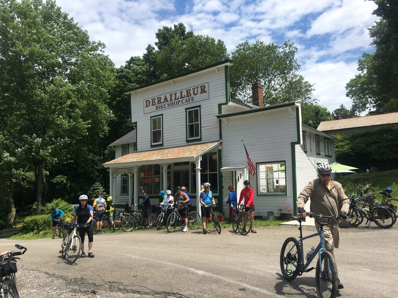
A trail town business on the GAP Trail
The first goal is to create a trail town guidebook that will primarily serve as an implementation blueprint and includes best practices and other shareable documents for anyone, both within MORPC’s region and beyond to use as they set their sights on becoming a trail town. In addition, the first phase will provide specific, easy to implement trail town infrastructure recommendations to 4-6 communities along the Ohio to Erie Trail.
What is a trail town? Good examples of trail towns can be found along Pennsylvania’s GAP (Great Allegheny Pass) Trail and along the Buckeye Trail, a 1,444 mile hiking trail loop in Ohio. Trail towns welcome travelers in many ways, including having easy to access amenities such as restrooms, food, lodging, secure parking for bikes, and helpful signage.
What does it take to be a trail town? The criteria varies, depending on where you are. This initiative will be looking at models that currently exist, especially the trail towns of the Buckeye Trail and GAP Trail.
Why do we need trail towns? Travelers recognize trail towns as places they can find everything they may need to support themselves. By having established trail towns, visitor numbers will go up, and benefits of trail tourism will help support economic vitality within the small towns. Trail towns not only encourage tourism, but they provide important quality of life amenities to residents already living nearby including walkable town centers.
How soon before a trail town is established along the Ohio to Erie Trail? The initial phase of creating a community guidebook is scheduled to take about a year. After the initial phase, it may be a few years before communities can secure funding to add what amenities are necessary. The good news is that many towns are off to a good start and have some of the amenities that will qualify them as a trail town so the time frame could be a lot less. There are even some communities along the OTET that already draw tourists and cyclists from across the country and have established themselves as trail friendly places.
For an update on progress on the Ohio & Erie Towpath Trail, see here – http://canalwaypartners.com/towpath-trail/
Stark County: The Stark County Park District has paved a couple sections that have been troublesome due to periods of high water washing away the trail surface. The newly paved sections are north of Canal Fulton between the Stark and Summit County lines as well as a short piece of trail just south of Canal Fulton near Lock 4 Park.
The Army Corps of Engineers is working on the flood easement levee in Massillon and periodic closures of the trail will be necessary throughout 2021. The area affected is between Cherry Street and Lake Avenue. Detour signs are posted. No word on how long it will be closed.
Massillon Area Greenways Inc (MAGI) is still planning on doing improvements to the trail and its environs as it enters Massillon from the west.
Wayne County has received state capital appropriation to fund a .3 mile segment and a small parking area and drainage improvements. the substantial completion date is 11/30/21 with total completion in the spring of 2022.
A TAP grant has been awarded in partnership with the city of Orrville. Design engineering has started and the completion date is set for fiscal year 2024.
Holmes County: A new segment of trail is funded thanks to the efforts of the State of Ohio, Holmes County Park District, Ohio to Erie Trail board contributions, and local funding activities such as the Holmes County annual auction. A review by ODOT has been conducted and the project will be modified slightly to gain ODOT approval. Construction has been delayed due to necessary easements needed. Construction is now scheduled to start January – February of 2022.
Delaware County: A critical 1.1 miles of the OTET north of Sunbury was constructed in the fall of 2021, thus eliminating five miles of on road route. Also, a request for funding to the ODNR Clean Ohio Trail Fund program was submitted. This request was for 1,500 feet of trail near Sunbury with a tentative 2022 construction timeframe.
Licking County: Engineering design is nearly complete for a small segment of paved trail. The proposed schedule is advertising for construction in January with completion date of May 2022.
Knox County: An ODNR Clean Ohio Fund grant was awarded to construct the remaining 1.1 miles of the Heart of Ohio Trail to the Licking County line. This project is currently in the design engineering phase.
Franklin County: The Downtown connector trail (next to I-670) is being widened and repaved during 2021-2022. Phase 1, from Nelson Road/Alum Creek connection to Leonard Avenue has been completed. Phase 2 will be from Leonard to the end of the path @ Ft Hayes/Cleveland Avenue will be complete in 2022. This is a complete rebuild and includes improvement of the crosswalks and safety of the path. Pavement markings that include a designated bike lane will be added North of Camp Chase along McKinley Road to Eureka. This work is scheduled to be completed by April 2022.
Madison County: Friends of Madison County Parks and Trails are working with Madison County Commissioners to raise funds for land acquisition to construct a 1 mile segment in downtown London.
Hamilton County: Anderson Township secured $750,000 from OKI (Ohio-Kentucky-Indiana Regional Council of Governments) to construct a .35 mile new trail access point from the planned Beechmont Bridge project to Elstun Road. ODOT District 8 is currently designing the project with Anderson Township with an estimated date of completion of 12/31/2024.OKI, along with Great Parks of Hamilton County funded the Beechmont Bridge connection between the Little Miami Scenic Trail and Lunken Airport on 12/28/20. Construction on this .4 mile segment is scheduled to start 3/14/21 and finish 8/31/22.
A 0.5 mile segment of trail is under construction as of early March and is scheduled to be completed fall 2022. This section will link the Little Miami Scenic Trail to Lunken Airport Trail, Armleder Park Trail, and the Ohio River Trail.
The seven-day, six-night Moffitt Memorial annual ride is being planned for 2022. Dates for this fully supported tour are Saturday, September 10 – Friday, September 16.
Tour Capacity:
50 riders
Daily Mileage: Distances range from 30 to 67 miles. Shorter days allow for a more leisurely ride or site-seeing along the way.
Terrain: Trail surfaces are fine for road bikes, hybrids and mountain bikes. While 90% of the trail is essentially flat, there are some hills along the way that are typical for Ohio cycling.
Overnight Lodging: Riders stay at hotels at special rates.
SAG (Support and Gear):
This ride is fully supported with luggage transfers, on-route vehicles, a mechanic and OTET staff. Participants only need to carry what they will need for the day. Support water and snack stops are about every 15 miles.
Pricing: The cost is variable, depending on the date of registration, ranging from $795 to $895.
A unique aspect of this ride is that much of the cost is considered to be a tax-deductable DONATION. Food and lodging are paid for by the participants.
We anticipate opening registration in December. Watch our website and social media for updates.
Public art, restaurants, lodging, ice cream, public restrooms, and beautiful parks and rivers make Loveland a welcoming community for all trail travelers. In fact, Loveland is recognized as a Trail Town by the Buckeye Trail, a 1,444 mile hiking trail loop that passes through the city.
Many long distance travelers of the Ohio to Erie Trail find themselves planning a lay-over day in Loveland because there is so much to do and see. Approximately 120,000 trail users pass through this area each year. This number increases to 250,000 when you consider trail uses, which includes people using the trail as a destination rather than a “pass through corridor”. This article highlights some of the don’t miss places in Loveland that you can use to plan your trip.
If you don’t have a bike with you, start at Loveland Bike Rentals, which offers weekend rentals from March through November and daily mid-May through mid-August.
If you’re looking for lodging accommodations, you have the option of roughing it at a primitive campsite located about 1,000 feet north of Nisbet Park, so you’ll be close to the public restrooms, which were newly upgraded in 2020. To reserve a spot, click on this link and then fill out the “Buckeye Trail Town Camp Site Request” form. https://www.lovelandoh.gov/requesttracker.aspx
If you’re looking for something more chic, check out the Loveland Lofts, which opened in spring of 2020, located across from Montgomery Cyclery at 210 West Loveland Avenue.
Once you get settled in, sample some local brews and spirits at Narrow Path Brewing Co or Cappy’s Wine and Spirits. Restaurant options are plentiful, ranging from a grab-and-go healthy tacos at Tahona Kitchen and Bar or sandwiches at Paxton’s Grill to many sit-down full service locations. Enjoy a burger and beer at Ramsey’s Trailside or for a special treat, check out Bishop’s Quarter which has a full bourbon selection. Authentic Italian fare is the specialty at Enoteca Emilia. Or go a little more casual at The Works. Reservations are recommended for many of these locations, so plan ahead!
After dinner take a leisurely walk along the trail and enjoy the scenery of the Little Miami Scenic River, a state and nationally designated scenic river. For an after dinner treat, your options are the Loveland Sweet Shop, Trailside Ice Shack Italian Ice, Graeters Ice Cream, Trailside Provisions, or Loveland Dairy Whip.
Start your morning off right with coffee and a treat at Cocoa Bites or Mile 42 Coffee. Head over to Loveland Canoe and Kayak for an adventure on the Little Miami Scenic River. Then, spend some time browsing the many boutiques within walking distance of the trail. Alley Boutique, Lemons and Limes, Haven Grey, Busy Bee, and Blume have unique, eclectic items for you and your home!
If you forgot a critical piece of gear at home, be sure to stop by Vertical Drop, an outfitter that supplies kayaking, stand up paddle boards, and other outdoor apparel. For your cycling needs, Montgomery Cyclery has the parts and service to get your riding again.
Once you are ready to start your trip along the trail, be sure to park your vehicle at the Linda Cox parking lot close by, which offers multi-day parking for trail users.
The Loveland community values the trail so much, that people are willing to pay a $9,000 premium to live within 1,000’ of the trail. This data comes from a 2011 University of Cincinnati property value impact study.
Spend some time in Loveland and you’ll soon be planning your return visit!
The Towpath Trial is closed in Massillon between Cherry Rd. and Lake Avenue (Ernie’s Bicycle Shop) due to Army Corps construction work on the flood levee.
The suggested alternate route is Third Street, which parallels the trail on the west side of the river. The detour is approximately 3/4 mile.
Signs have been posted at each end of the closure explaining the re-route.
As work areas on the levee change, closures will change, necessitating different re-routes. Those routes are currently being discussed by city and county officials along with input from MAGI (Massillon Area Greenways Inc.).
On another note, Stark Parks will be replacing a bridge on the Sippo Valley trail this fall. Coming from the west, it is the first bridge in Stark County. The trail will be closed while the work is completed. More on this as we get closer to a construction date.
Currently lots of high water, but no serious damage to trails in Stark County!
As expected, several trails will be closed due to flooding for a few days this week. We will work on any debris and clean up so the trails are ready for the weekend and more sunshine. As always, you can link, bookmark, or frequently check…. https://starkparks.com/park-trail-alerts/
Here is the list:
The Towpath Trail has several sections under water including north of Lake Lucerne and Lake Lucerne Trailhead, Lock 4 area and lower parking lot, under Lake Ave. and Rt. 21 in Massillon, and south of Wooster St. in Navarre.
On a related note, updates have been slower than anticipated but the Towpath Trail between Cherry St. and Lake Ave. is now closed as work begins on erosion control and bank stabilization. Fencing is in place with barricades and signage, we will continue to work with the Army Corps of Engineers and pass them along to you. The schedule is expected to remain the same with the closure lasting into 2022. Any references to the trail being open on weekends are no longer valid.
The Hoover Trail at Washington Square in North Canton has several flooded areas at this time.
The Middle Branch Trail north and south of Martindale Rd. has water over the trail.
04/29/2021–Brecksville, OH – The National Park Service has closed the Ohio & Erie Canal Towpath Trail between Rockside Road and Frazee House in Valley View due to Cuyahoga River flooding.
Please respect all park closures for the safety of visitors, resources, and park staff. Please do not drive through flooded roadways.
Note that the organization posting this information has no more knowledge of the closures other than what is publicly announced.
FOR MORE DETAILS For more information regarding closures along Little Miami State Park’s trail, call the park office at 937-382-1096 or visit the ODNR website at ohiodnr.gov.