GO TO Route Alerts for additional information
Heart of Ohio Trail, newest
The newest segment linking Delaware, Licking and Knox Counties is NOW open! New Trail Guides will be printed this Fall and until then, an updated NC4 map panel is now available for download here.
June 4, 2022
5/9/22 – Little Miami Scenic Trail, Grandin Road
Starting Monday May 9, 2022, and lasting approximately 8 months, the Little Miami Scenic Trail will be closed at Grandin Road for a project to replace the King Avenue bridge, add a roundabout, and realign the Trail itself. The Warren County Engineer’s office announced the specific date for this closure on April 28, 2022. There will be no detour for this closure. Visit MiamiValleyTrails.org for details.
https://www.miamivalleytrails.org/little-miami-scenic-trail-closed-grandin-road If you want to talk with someone who has been through there recently, join the Facebook Enthusiast Group and post your question. There are over 10,000 members already, so you may get lots of advice!
5/16/22 – The Ohio to Erie Trail Interactive Map provides an option for going around the Little Miami Scenic Trail closure in Warren County.
For the Ride with GPS instructions for the Grandin Road Construction Optional Street Route:
https://ridewithgps.com/routes/39462376
Road route from Foster’s Park Trailhead to South Lebanon Trailhead
Visit the Interactive Map at https://ohiotoerietrailarchive.org/interactive-map/#interactivemap

Grandin Road Ride Around (northbound)
| Leg | Dir | Type | Notes | Total |
| ← | Left | Turn left onto Old 3C Highway, C-10 | 0.0 | |
| 0.2 | ← | Left | Turn left | 0.2 |
| 0.2 | ↑ | Straight | Continue onto Stillwater Drive | 0.4 |
| 0.1 | → | Right | Turn right onto Harkers Run | 0.6 |
| 0.1 | ← | Left | Turn left onto Scioto Court | 0.6 |
| 0.0 | ← | Left | Turn left onto Harkers Run | 0.6 |
| 0.1 | ← | Left | Turn left onto Marsh Creek Lane | 0.7 |
| 0.1 | → | Right | Turn right onto Autumn Run Drive | 0.8 |
| 0.3 | ← | Left | Turn left onto Striker Road, T-151 | 1.2 |
| 0.3 | ↑ | Straight | Continue onto Striker Road, T-151 | 1.5 |
| 0.7 | → | Slight Right | Turn slight right onto Striker Road, T-151 | 2.2 |
| 0.1 | → | Right | Turn right onto Grandin Road, C-150 | 2.3 |
| 0.1 | ← | Left | Turn left onto Grandin Ridge Drive | 2.4 |
| 0.5 | ← | Left | Turn left onto Ridgeview Lane | 2.9 |
| 0.7 | ← | Left | Turn left onto SR 48 | 3.6 |
| 0.6 | ← | Left | Turn left onto Lebanon Road | 4.2 |
Ride With GPS · https://ridewithgps.com
8/10/22 – Update to Massillon Detour
The closed portion of the Towpath just south of Ernie’s Bike Shop in Massillon has been extended. The trail is now closed from Lake Avenue to the Tremont bridge. Ernie’s Bike Shop has provided a bypass route suggestion. Go to: https://www.erniesbikeshop.com/towpath for route and map.
If you have questions about navigating this part of the trail, stop by the bike shop at 135 Lake Ave NW, Massillon, OH 44647 or call 330-832-5111. Read more at https://www.erniesbikeshop.com/towpath where you can Download Printable Directions.
7/20/21 – Update to Massillon Detour
The Towpath Trial is closed in Massillon between Cherry Rd. and Lake Avenue (Ernie’s Bicycle Shop) due to Army Corps construction work on the flood levee.
The suggested alternate route is Third Street, which parallels the trail on the west side of the river. The detour is approximately 3/4 mile.
Signs have been posted at each end of the closure explaining the re-route.
As work areas on the levee change, closures will change, necessitating different re-routes. Those routes are currently being discussed by city and county officials along with input from MAGI (Massillon Area Greenways Inc.).
On another note, Stark Parks will be replacing a bridge on the Sippo Valley trail this fall. Coming from the west, it is the first bridge in Stark County. The trail will be closed while the work is completed. More on this as we get closer to a construction date.
Currently lots of high water, but no serious damage to trails in Stark County!
Flooding in Massillon Area
Hello Trail Partners and Friends,
As expected, several trails will be closed due to flooding for a few days this week. We will work on any debris and clean up so the trails are ready for the weekend and more sunshine. As always, you can link, bookmark, or frequently check…. https://starkparks.com/park-trail-alerts/
Here is the list:
The Towpath Trail has several sections under water including north of Lake Lucerne and Lake Lucerne Trailhead, Lock 4 area and lower parking lot, under Lake Ave. and Rt. 21 in Massillon, and south of Wooster St. in Navarre.
On a related note, updates have been slower than anticipated but the Towpath Trail between Cherry St. and Lake Ave. is now closed as work begins on erosion control and bank stabilization. Fencing is in place with barricades and signage, we will continue to work with the Army Corps of Engineers and pass them along to you. The schedule is expected to remain the same with the closure lasting into 2022. Any references to the trail being open on weekends are no longer valid.
The Hoover Trail at Washington Square in North Canton has several flooded areas at this time.
The Middle Branch Trail north and south of Martindale Rd. has water over the trail.
Jared Shive
Public Relations Coordinator
Ph 330-409-8996
5712 12th Street NW
Canton, Ohio 44708
Towpath Trail section in Cuyahoga Valley National Park closed due to flooding
04/29/2021–Brecksville, OH – The National Park Service has closed the Ohio & Erie Canal Towpath Trail between Rockside Road and Frazee House in Valley View due to Cuyahoga River flooding.
Please respect all park closures for the safety of visitors, resources, and park staff. Please do not drive through flooded roadways.
Significant Closures of Little Miami Trail during 2021 Season
A segment of the trail along the Little Miami segment will be closed most of the summer.
Details are here: https://www.wcpo.com/news/local-news/warren-county/highly-used-warren-county-state-park-trail-getting-major-work-through-summer?fbclid=IwAR0P1WpKke5iMQy8xa_u6rePBQLjEqos4ixPPez4DRX3dFGBPy35osp0e84
Note that the organization posting this information has no more knowledge of the closures other than what is publicly announced.
FOR MORE DETAILS
For more information regarding closures along Little Miami State Park’s trail, call the park office at 937-382-1096 or visit the ODNR website at ohiodnr.gov.
Massillon Detour
3/24/2021
CAUTION: This detour is on roadway. Please obey all traffic laws and pay careful attention while riding the detour.
Note: Depending on how busy they are, Ernie’s Bicycle Shop in Massillon can provide shuttling for people and bikes from the Massillon Hampton Inn to the north side of the detour and in the opposite direction. Contact them and please thank them!
Knox County Construction
August 2020
Mount Vernon construction updates: Several traffic projects are underway in Mount Vernon that will improve the cycling infrastructure for trail users.
Mount Vernon Avenue: Work continues the replacement of the Mount Vernon Avenue bridge over the Kokosing River. Work has shifted to the westbound lanes with the eastbound bridge construction complete. The Kokosing Gap Trail travels on a 12’ protected bike lane on the bridge to a traffic signal at Cougar Drive. Trail users can safely cross Mount Vernon Avenue and continue to the trail on the levee. The westbound bridge beams will be set into place from August 24-26. There may be delays during the movement of the beams. Trail users can continue through the construction zone at the direction of the construction crew.
Main Street: The construction of a trail underpass at Main Street is underway. A new underpass trail will begin on the Heart of Ohio Trail at the western edge of the CA&C Depot and pass under the Main Street Viaduct on the river’s edge. It will return to the levee and Kokosing Gap Trail east of the iron viaduct. The trail is open with intermittent delays for the movement of equipment and supplies. A detour will be in effect and marked once the construction reaches the point of merging the exiting trail into the new underpass trail. Trail users can continue using the trail until the contractor places barricades on the trail and directs trail users to the detour.
Status Alert for Towpath Trail in Massillon 2020-2021
Towpath Trail Closure And Unpredictable Trail Conditions
Expect unpredictable trail conditions through July 2020 while a project near the Massillon Sewer Plant is happening. Use caution and plan on walking bikes through the area. An ongoing levee project near the Tuscarawas River in Massillon by the U.S. Army Corps of Engineers will impact travel for an extended period. The work will cause intermittent closures of the Towpath Trail. Weekday closures between Lake Ave. Trailhead in Massillon and Finefrock Rd. in Massillon will begin in Aug. 2020. The trail will be open on weekends. Please obey all construction and safety signs and be cautious of unpredictable trail conditions. This is a long term project that will affect various sections of the Towpath Trail in this area throughout 2020 and 2021.
Camp Chase Detour in Effect
Construction Closure: Camp Chase Trail is closed from Wilson Road Park to Derrer Road for road improvements on Wilson Road bridge above the trail. Follow signs for the detour.
National Park Service to close Ohio & Erie Canal Towpath Trail section for repairs May 4 – 15, 2020
BRECKSVILLE, Ohio – The National Park Service (NPS) will close a section of the Ohio & Erie Canal Towpath Trail, between Canal Exploration Center and Frazee House in Valley View. The trail will be closed 7 am – 5 pm on weekdays, May 4 –15. It will be open for use in the evening and on weekends. Contractors will be repairing the Tinker’s Creek aqueduct bridge decking and stone retaining walls.
No detour is available. The closure is necessary for public safety, please respect all closures.
CVNP encompasses 33,000 acres along the Cuyahoga River between Cleveland and Akron, Ohio. Managed by the National Park Service, CVNP combines cultural, historical, recreational, and natural activities in one setting. For more information, visit www.nps.gov/cuva, www.facebook.com/
7/31/19
We are hearing that travelers are getting confused in the Cleveland area because there is a lot of construction and changes. Here is the most recent status:
TIGER Project: Cleveland Metroparks Update
https://www.clevelandmetroparks.com/about/cleveland-metroparks-organization/future-plans/re-connecting-cleveland-tiger-grant-project. In February, construction began on two important connector trails that are part of the TIGER project. which will connect the Cleveland Foundation Centennial Trail Lake Link to the Cleveland Lakefront Bikeway. The Lakefront Bikeway is finished. It begins at Edgewater Park and ends at West 28th or West 25th.
OTET -Towpath Trail: Riding the OTET north
- Stage 1: (Harvard to Steelyard, In Progress) The O&E Canal Towpath Trail (Towpath) ends at Harvard Avenue. Turn left on Harvard and take Harvard to Jennings Road. Turn right or north on Jennings and take it up to Steelyard Commons – Presently all roads are under construction, but passable. The southern end of the Towpath Trail behind Steelyard Commons is currently under heavy construction and is not passable. You must continue riding north on Jennings until you can make a right turn further into Steelyard Commons Parking lot at the north end of the Plaza. Return to the towpath trail behind Steelyard Commons Plaza.
- Stage 2: Not part of OTET
- Stage 3: (Steelyard to Literary, Complete) This Towpath section is now completed. When returning to the Steelyard Commons Towpath trail continue to travel north passing under two tunnels. After the second tunnel, stay right on the towpath and you will enter the newly completed Urban Scenic Towpath. Continue north on the new section until reaching Literary in Cleveland’s Historic Tremont District. Taking a left onto Literary the towpath turns into University Street which is one way heading south-not north for a short distance.
- Stage 4: (Literary to Cleveland’s Lakefront Bikeway, Complete) Stay on Literary until you reach West 14th Street. Turn right on West 14th until it dead ends into Abbey Road. Turn left on Abbey Road past the Cleveland sign to West 25th Street. Turn right on W 25th to and left on Franklin Boulevard. Turn right on West 28th and take it all the way to Cleveland’s new Lakefront bikeway just north of Detroit Avenue on the left under the bridge. Take the Lakefront Bikeway east to Edgewater Park.
7/21/19
6/3/19
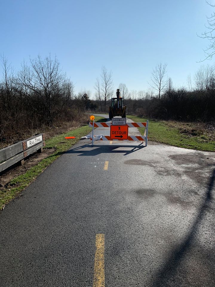
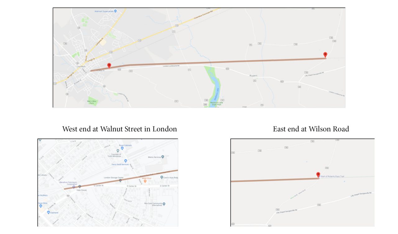
Roberts Pass Trail Closed June 10-14
The Madison County Engineering Department will be sealcoating the Roberts Pass section of the Ohio to Erie Trail starting June 10, 2019 for approximately three days (weather permitting). Please avoid the section from Wilson Road in Madison County to Walnut Street in London during this time due to construction equipment and wet sealcoating on the trail. This section is approximately 7 miles in length.
Potential Road Alternative:
SR 665 is roughly parallel to the south of this section of trail. Use extreme caution on this highway. Use only if necessary.
Westbound: Turn left (south) from the trail onto Wilson Rd., go to Lilly Chapel Georgesville Rd. and continue to SR 665. Turn right (west) and go about 6 miles to Walnut St. and follow trail street route signs across London.
Eastbound: From Walnut St. proceed south to SR 665 (Center St.) Turn left (east) approximately 6 miles to Lilly Chapel Georgesville Rd. and turn left (north). Bear left onto Wilson Rd. and continue to the trail crossing and turn right (east).
Drive, Park, and Ride Consideration: If you normally drive to Battelle Darby Metro Park and park at the Camp Chase Trail parking area and ride west towards London, you might consider driving to the Prairie Grass Trailhead in London to park and ride further west. The same for Wilson Road Trailhead if you normally drive there to park. If you have not ridden that far west in the past, this may be the opportunity. South Charleston is only about 11 miles west of London and has a nice trailhead, restaurants, coffee shop, and ice cream store to visit before your return to the Prairie Grass Trailhead.
Roberts Pass
5/28/19
5/21/19
3/18/19
Section of Towpath Trail in Summit Metro Parks to close until early June

A section of the Towpath Trail in Summit Metro Parks will be closed until early June 2019.
AKRON, Ohio — A one-mile section of the Towpath Trail in the Summit Metro Parks in Akron will close Tuesday and remain closed through early June.
The closure runs from Manchester Road to Ohio 224, Summit Metro Parks spokeswoman Stephanie Walton told cleveland.com on Monday. There will be no detour.
An Army Corps of Engineers invasive species project will construct a barrier in the area to prevent Asian carp from traveling into the waterways, Walton said. Cargill has utility lines running under the Towpath Trail and needs to move them in order for crews to complete the project.
“We generally discourage people traveling off of the Towpath onto local roads, so there will not be a marked detour available,” Walton said.
The section of the Towpath Trail will be open for the Towpath Century Ride on June 8, Walton said.

Summit Metro Parks@metro_parksTrail Alert: The Towpath Trail will be closed between Manchester Rd. and State Route 224 for utility work necessary for an Army Corps of Engineers invasive species project. The closure begins Tuesday, March 19 and continues through early June 2019.

Route Alerts 12/14/18
Cuyahoga Valley National Park News Release
Pamela Barnes, 440-546-5994, 440-241-5857 (cell), or pamela_barnes@nps.govFor Immediate Release Friday, December 14, 2018
National Park Service to Temporarily Close Towpath Trail Section
Brecksville, Ohio – The Ohio & Erie Canal Towpath Trail between Deep Lock Quarry and Hunt House will be closed beginning Monday, December 17, while a contractor installs a steel pedestrian bridge. The closure will likely continue through late winter or early spring.
The temporary closure is necessary for public safety. There will be no detour available. Please respect the closure.
This bridge is the last of four slated for replacement. Earlier in 2018, installation was halted when workers encountered a previously undiscovered stone culvert that was original to the Ohio & Erie Canal. Engineers have been working to redesign the abutment, and the bridge can now be installed without adverse effects on historic resources. The temporary detour that has been available since mid-summer will not be open during this phase.
Route Alerts 10/22/18
Cuyahoga Valley National Park News Release
Ohio & Erie Canal Towpath Trail Section Closed October 23
BRECKSVILLE, Ohio – The National Park Service will close a section of the Ohio & Erie Canal Towpath Trail in Cuyahoga Valley National Park Tuesday October 23, 7 a.m. – 4:30 p.m. The trail closure between Frazee House and Station Road Trailhead is necessary for public safety while workers repair a bridge that crosses the Sagamore waste weir.
Please respect all park closures for the safety of visitors, resources, and park staff.
CVNP encompasses 33,000 acres along the Cuyahoga River between Cleveland and Akron, Ohio. Managed by the National Park Service, CVNP combines cultural, historical, recreational, and natural activities in one setting. For more information, visit www.nps.gov/cuva, www.facebook.com/cuyahogavalleynationalpark, or call 330-657-2752.
Route Alerts 10/16/18
Route Alerts 10/1/18
Towpath Trail Closed For 27th Annual Towpath Marathon
Brecksville, Ohio – The Ohio & Erie Canal Towpath Trail in Cuyahoga Valley National Park will be closed to the general public starting at dusk Saturday, October 6 until 2 p.m. on Sunday, October 7. All of the parking lots along the Towpath Trail from Frazee House Trailhead to Botzum Trailhead including Indigo Lake Trailhead will be closed. Expect limited delays due to short road closures in the morning hours on Sunday, October 7. The closure is due to the 27th Annual Towpath Marathon, a specialty marathon, half marathon, and 10K race, sponsored by Canalway Partners, a Founding Organization of the Ohio & Erie Canalway National Heritage Area.
Route Alerts 8/31/18
The Cleveland area has a lot of progress going on and will continue to change until 2020.
The information located on this map pertains to panel N1 just before you get to the Lakefront area.
The information located on this map pertains to panel N2 in the Jennings Rd./Steelyard Commons area.
Alerts in Central Ohio are detailed at this link:
http://centralohiogreenways.com/news-alerts/
7/28/18 Alert:
Alum Creek Trail by Easton in NE Columbus has maintenance work, through access will stay open, slow down and proceed with caution. You may be delayed if there is active construction. Duration is through first week of September 2018.
MORE HERE: www.centralohiogreenways.com/news-alerts/
4-15-18
Flooding along trail in Cuyahoga National Valley Park
Updates as of 11-1-17
This web site no longer supports the OTET Maps sold prior to 2-2017. So many changes along the Ohio to Erie Trail route makes up-dates entirely too cumbersome. New Tour Guides are available in the web site store.
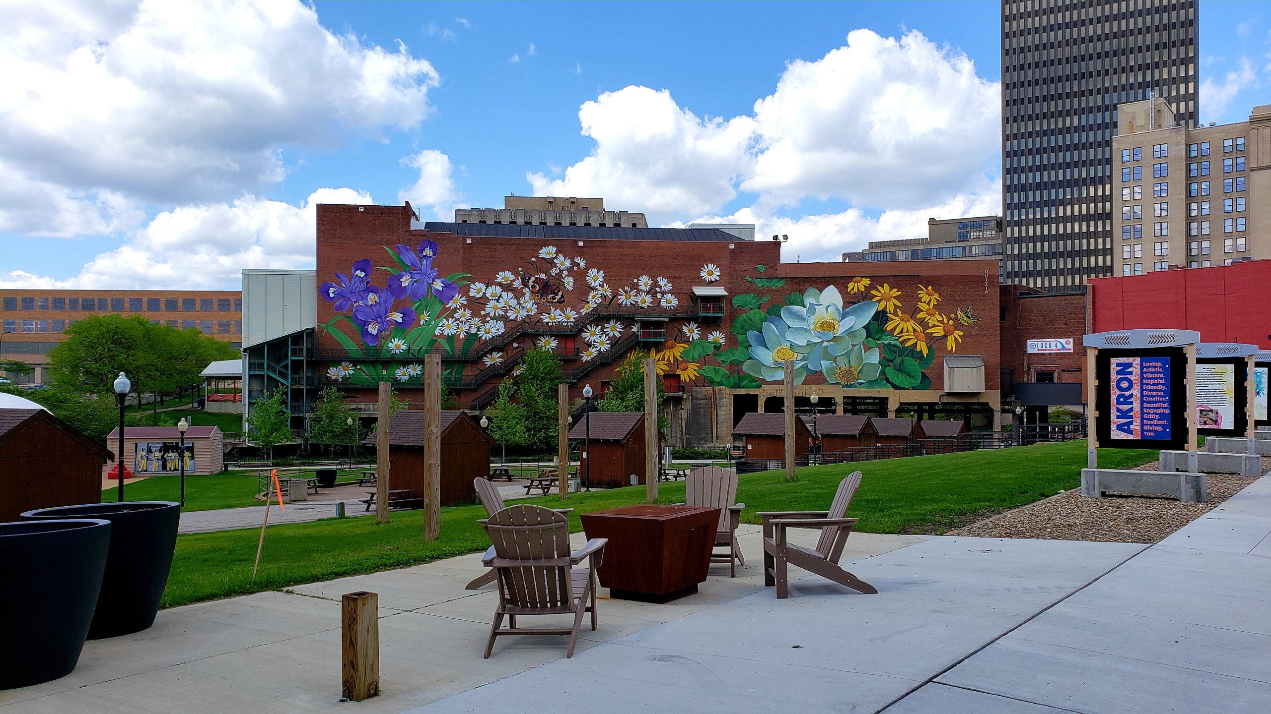
North Region – Panel N3 – Akron – a section of the Ohio to Erie Trail known as the Ohio & Erie Canal Towpath Trail in Akron has a one-mile detour between the current Memorial Parkway and Mustill Store Trailheads. The detour uses Hickory Street to the west of the Trail until 2018 during construction. This detour of Towpath Trail and Ohio to Erie Trail does provide a safe, easily identifiable and mostly accessible trail for hikers and bicyclists. There are short sections that involve steep grades along the Maple Street Connector of the new route – 10% & 15% – where walking a bike may be preferred. It is signed. Also note that the area in Akron has no Route 1 signs. We are still working with the folks there to realize the OTET is STATE wide.
North Central Region – Panel NC1 North of Mohican Valley Trail – This panel shows a new section of the Holmes County Trail from the Mohican Valley Trail to Glenmont that is now opened! Follow Route 1 signs to Killbuck on Route 520.
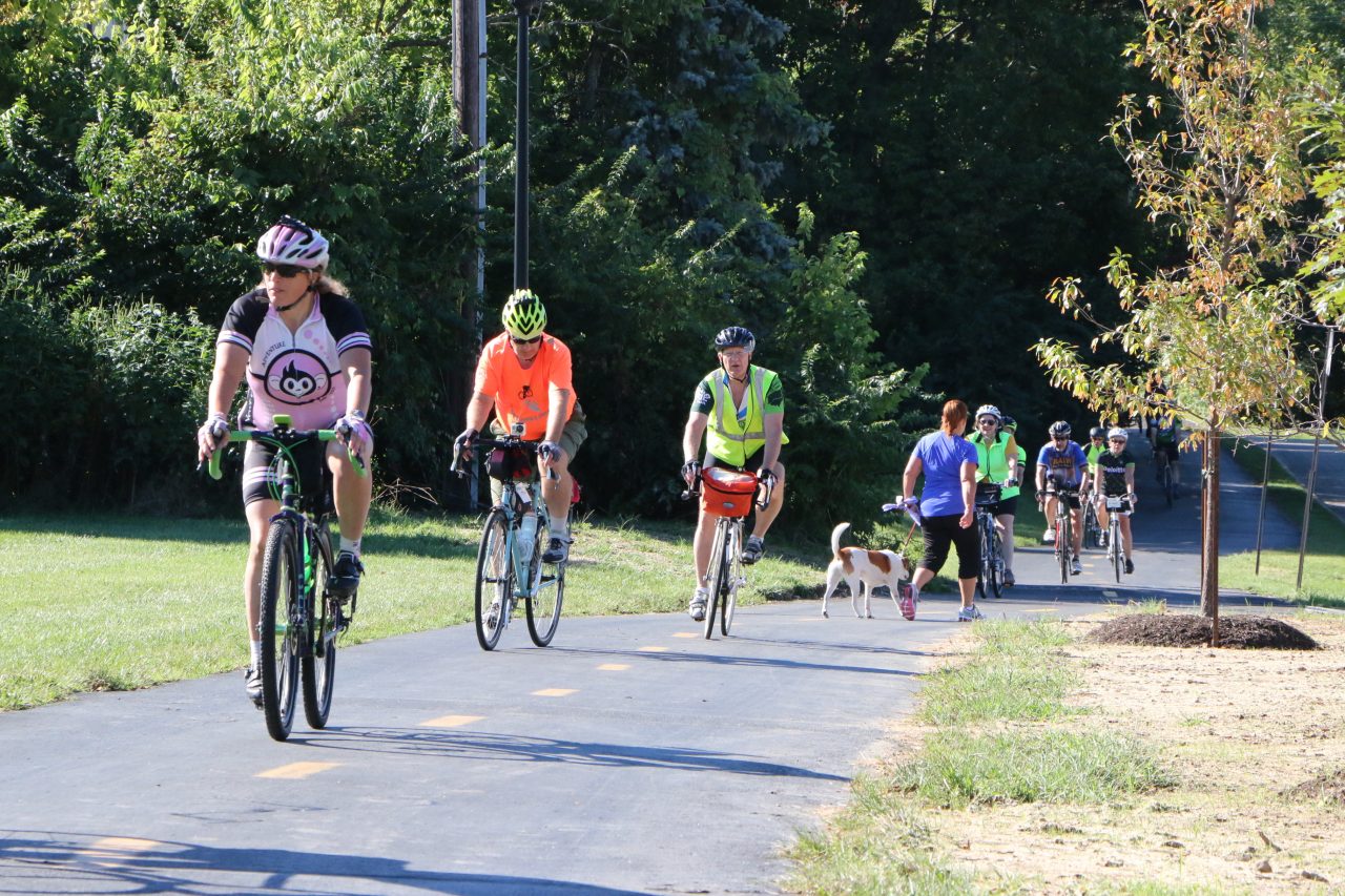
North Central Region – Panels NC5 and NC6 – Westerville City – note that in the City of Westerville there are plenty of very nice white and green signs that say Ohio to Erie Trail and other OTET signs that are high on poles or on lower sign panels. There are NO route 1 signs for about 6 miles through this busy city but most of the trail is on the Westerville Bike and Hike Path. Watch carefully for the signs for OTET. They have an abundance of the US BR 50 signs and it does follow the OTET for much of the way but it goes east and OTET goes northeast. The OTET Tour Guides will take you through, so follow them!
South Region – Panels S4, 5 & 6 -Cincinnati – this is a navigation clarifications and not route changes from the tour guide. Two areas need traveler attention. Going towards Cincinnati after turning on to Kellogg Avenue from Carrel, in one-half mile the trail goes left (south) around the back of the school on stilts and not straight on Kellogg Avenue. While the trail returns to Kellogg/Riverside Drive later, this beautiful one mile trail section winds along the Ohio River where there are ball fields and a boat ramp with very little car traffic compared to Kellogg. When the trail ends at Corbin, turn right for one block and you are back on Kellogg which now has become Riverside Drive to the city and it is well marked. Turn left at Riverside and Corbin toward downtown Cincinnati.
Updates as of 9/15/17
North Region – Panel N3 – Akron – a section of the Ohio to Erie Trail known as the Ohio & Erie Canal Towpath Trail in Akron has a one-mile detour between the current Memorial Parkway and Mustill Store Trailheads. The detour uses Hickory Street to the west of the Trail until 2018 during construction. This detour of Towpath Trail and Ohio to Erie Trail does provide a safe, easily identifiable and mostly accessible trail for hikers and bicyclists. There are short sections that involve steep grades along the Maple Street Connector of the new route – 10% & 15% – where walking a bike may be preferred. It is signed. Also note that the area in Akron has no Route 1 signs. We are still working with the folks there to realize the OTET is STATE wide.
North Central Region – Panel NC1 North of Mohican Valley Trail – This panel shows a new section of the Holmes County Trail from the Mohican Valley Trail to Glenmont . This should be paved and open by September 1, 2017. The Route 1 bicycle signs remain on the old route using County 25 and County 6 to take you to County 520 and into Killbuck. This is a very beautiful alternate route on the OTET and is marked with ALT stickers on the Route 1 signs. It is hilly in several spots but traffic is very light except for an occasional horse and buggy.
North Central Region – Panels NC5 and NC6 – Westerville City – note that in the City of Westerville there are plenty of very nice signs that say Ohio to Erie Trail but they are on poles and lower sign panels. There are NO route 1 signs for about 6 miles through this busy city but most of the trail is on the Westerville Bike and Hike Path. Watch carefully for the signs for OTET. They have an abundance of the US BR 50 signs and it does follow the OTET for much of the way but it goes east and OTET goes northeast. The OTET Tour Guides will take you through, so follow them!
South Region – Panels S4, 5 & 6 -Cincinnati – this is a navigation clarifications and not route changes from the tour guide. Two areas need traveler attention. Going towards Cincinnati after turning on to Kellogg Avenue from Carrel, in one-half mile the trail goes left (south) around the back of the school on stilts and not straight on Kellogg Avenue. While the trail returns to Kellogg/Riverside Drive later, this beautiful one mile trail section winds along the Ohio River where there are ball fields and a boat ramp with very little car traffic compared to Kellogg. When the trail ends at Corbin, turn right for one block and you are back on Kellogg which now has become Riverside Drive to the city and it is well marked. Turn left at Riverside and Corbin toward downtown Cincinnati. In 2.5 miles where you turn left (towards the Ohio River) is at Bain and Riverside at the red light. Use the red light to cross and enter the OTET at Berry International Friendship Park. ( It is possible to stay on Riverside and catch the trail at other places, but the easiest is to take this first sign of a trail on your left.) Go beyond the wooden art work to the path closest to the Ohio River and turn right. The first trail next to the train tracks will get you to the same location but the path closest to the river is much more scenic!
South Central Region (S to N directions) – Panel SC3 : where the CCT/OTET ends at W. Sullivant Ave. turn left and go 1 block west to Industrial Mile Rd. Follow it north and east to the intersection with Georgesville Rd. Use the pedestrian signal and crosswalk to cross to the east side of Georgesville Rd and go south (right) on the paved side path toward the RRx where the Camp Chase Trail resumes eastward into Columbus connecting to Columbus Wilson Park and the bridge over Broad Street (which is National Road U.S. 40). This is on the Tour Guide.
These web sites can be of assistance to you in the local areas they cover.
Little Miami: www.miamivalleytrails.org
Camp Chase Trail: www.campchasetrail.co
Central Ohio: www.centralohiogreenways.com
Delaware County: www.dcft.typepad.com
Ohio and Erie Canalway: www.ohioanderiecanalway.com
Madison County: www.fmcpt.com
Millersburg/Holmes County: www.holmestrail.org
Mt. Vernon/Knox County: www.knoxcountyparks.org Wayne County www.waynecountytrails.org