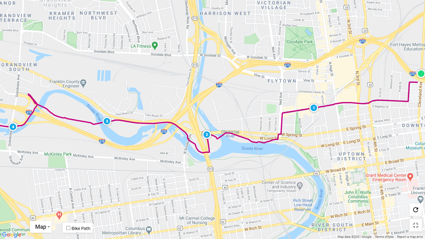
Download Columbus Northbound Turn-by-Turn Directions
START — Camp Chase Trail at Georgesville Road
Head northeast on Camp Chase Trail – 0.593 mi
Slight right to stay on Camp Chase Trail – 2.33 mi
Turn left onto N Eureka Ave – 292 ft
Turn right onto Valleyview Dr – 682 ft
Continue onto N Highland Ave – 896 ft
Continue onto Harper Rd – 1,053 ft
Turn left onto McKinley Ave – 52 ft
Turn right onto Hilltop Connector – 0.277 mi
Slight left onto Lower Scioto Greenway 0.785 mi
Turn left to stay on Lower Scioto Greenway 1.51 mi
Turn left to stay on Lower Scioto Greenway 659 ft
Turn right to stay on Lower Scioto Greenway 0.496 mi
Keep left to stay on Lower Scioto Greenway 344 ft
Turn left toward W Long St 43 ft
Turn right onto W Long St 72 ft
Turn left onto Neil Ave 974 ft
Turn right onto W Nationwide Blvd 0.649 mi
Continue onto E Naghten St 0.365 mi
Turn left onto Cleveland Ave 0.422 mi
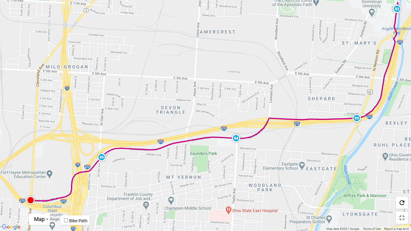
Turn right onto Downtown Connector/Jack Gibbs Blvd
Continue to follow Downtown Connector 2.08 mi
Turn right onto Alum Creek Trail
END — Intersection of Alum Creek Trail and Downtown Connector
RIDEwithGPS
To view more detail on the Columbus route go to the RidewithGPS files and download to your device. These files cover the 8.2 mile route in Columbus and are offered in either Northbound or Southbound options. Want a turn by turn cue sheet? Go to the route link shown and click MORE in the upper left and choose “Print Cue Sheet”
Northbound:
START: Camp Chase Trail at N. Eureka Ave and END: Alum Creek Trail.
https://
Southbound:
START: Alum Creek Trail and END: Camp Chase Trail at N. Eureka Ave
https://ridewithgps.com/
To see this route on our navigation files that mirror the printed map guide, click Columbus North Central and Columbus South Central map sections and zoom in.
Columbus North
Columbus South